Focus on Scotland - Captivating Caithness

North East Scotland is a remote land of vivid light, big skies and spectacular geology. Tempted to buy a holiday home or park home here? We find loads of reasons why you’ll love this region.
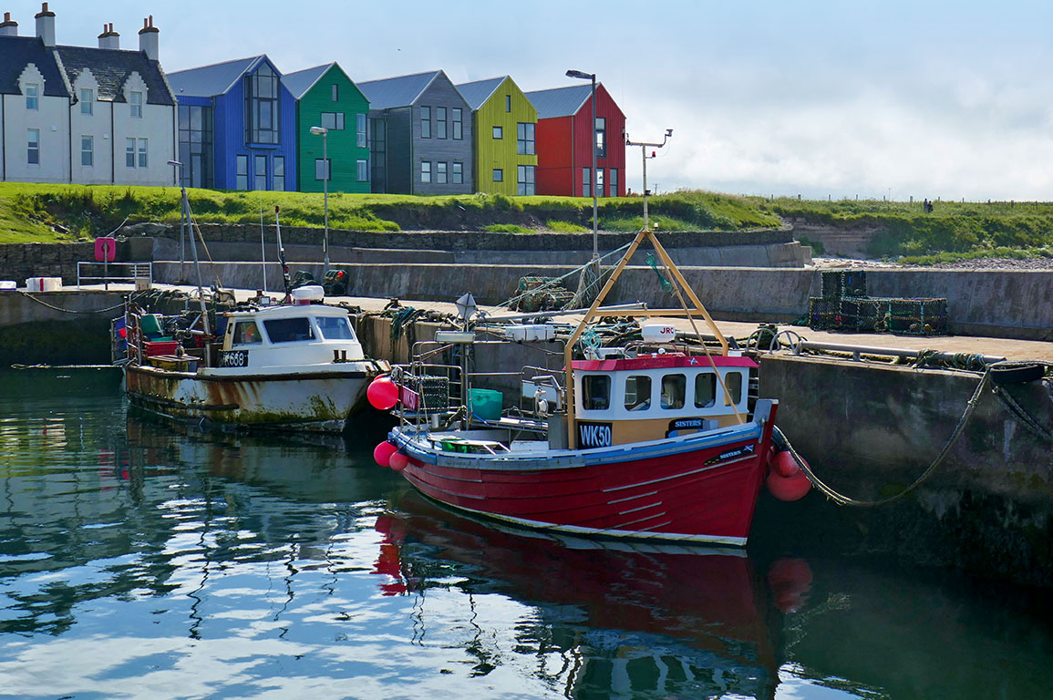
The county of Caithness, in north east Scotland, is ideal for hikers, birdwatchers and history-lovers. This remote land has big skies, vivid light, endless moorland and unrivalled coast. Around every corner the stories of people, from the Neolithic to the present, have been preserved in an exceptional landscape.
We disembarked from the Orkney ferry, picking up the single-track road towards Dunnet Head. Back in the Devonian period (around 400 million years ago), Caithness was mountainous and arid. The Old Red Sandstones were formed during this period, leaving layers of rock that split easily into flagstones. Where these sandstones meet the sea the layered structure creates sheer cliffs and stacks that are perfect for nesting sea birds.
Caithness
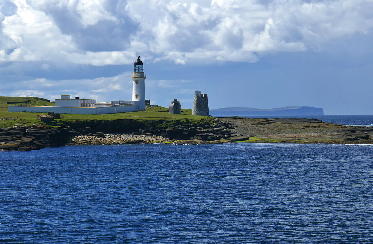
We reach the rocky promontory of Dunnet Head and walk to the cliffs. We see puffins, kittiwakes, fulmars and a seal bobbing in the waves. We walk along the coast by the lighthouse to a viewpoint; sandstone cliffs to one side, moorland dotted with lochs to the other. This was Caithness in miniature.
Following the coast to pretty Ham Bay, we explore the old four-storey corn mill and mill pond among fragrant meadowsweet.
By Gill’s Bay we watch an Arctic skua fly along the shore while looking out to the abandoned island of Stroma, just a few miles off the coast.
The Old Red Sandstone makes another dramatic appearance at Duncansby Head. The walk here is stunning and this wild coast contrasts with the commercialism of John O’Groats. With ever-changing views, precipitous cliffs, Thirle Door sea arch and two jagged cone-shaped sea stacks, it is breathtaking.
Neolithic stone burial cairns reveal clues about life here more than 5000 years ago.
Loch of Yarrows
Loch of Yarrows has a short archaeological trail that includes two Neolithic burial cairns. High above the loch, these neighbouring cairns were used for burials for over 1000 years.
Whereas archaeologists have some idea how burial cairns were used, the unique Caithness stone rows that the Bronze Age (4000 years ago) people left are a mystery. More than 170 stones remain. They are mostly knee-high and fan out in 23 rows with a central axis.
Nearby on a low rise above Loch Stemster is another setting of Bronze Age standing stones. Achavanich is a rare U-shape of 35 Caithness flagstones all around the height of a person.
Morven
A single-track road out of Dunbeath ends at a small parking area. From here there is a memorable six-mile return walk along the valley track into remote Caithness flow country, the magnificent pyramidal peak of Morven before you.
If you decide to ascend Morven (316ft) because it is the highest mountain in Caithness, be warned, it is a long and steep climb with bogs, scree and no marked path. The views from the summit over moorland, valleys and the bulk of Ben Hope 30 miles away are stunning.
Caithness is peppered with brochs – impressive Iron Age fortified round towers with a double wall enclosing stairs. Near Nybster we found the remains of a broch and, below, a fishing hut with a Caithness flagstone roof. Beside the site is a weathered ornate monument decorated with gargoyles.
Sutherland
A few days later – and further south in Sutherland – we came upon Carn Liath Broch, again with a clifftop position.
This well-preserved and remarkable broch gives a good sense of the sophisticated construction.
At the attractive harbour of Helmsdale, we ate in a local pub and wandered the harbour walls watching a seal bobbing in the water.
Whaligoe Steps
Whaligoe Steps has been on our list for some time and we grabbed the chance to explore this picturesque anchorage. Built in the 1700s, these steep steps were used by fishing folk. It is said there are 365 steps built into the cliff; I didn’t count them as I was too busy enjoying the views!
Helmsdale has a touching memorial to the people who were cleared from their productive land to make way for sheep farms in the 18th and 19th centuries. The deserted village of Badbea gives some idea of the hardship those evicted families underwent.
Moved to this exposed hillside, the forced settlers had to tether their sheep and children to stop them blowing into the sea! I walked between the haunting ruined crofts that homeless families had hand-built from scratch.
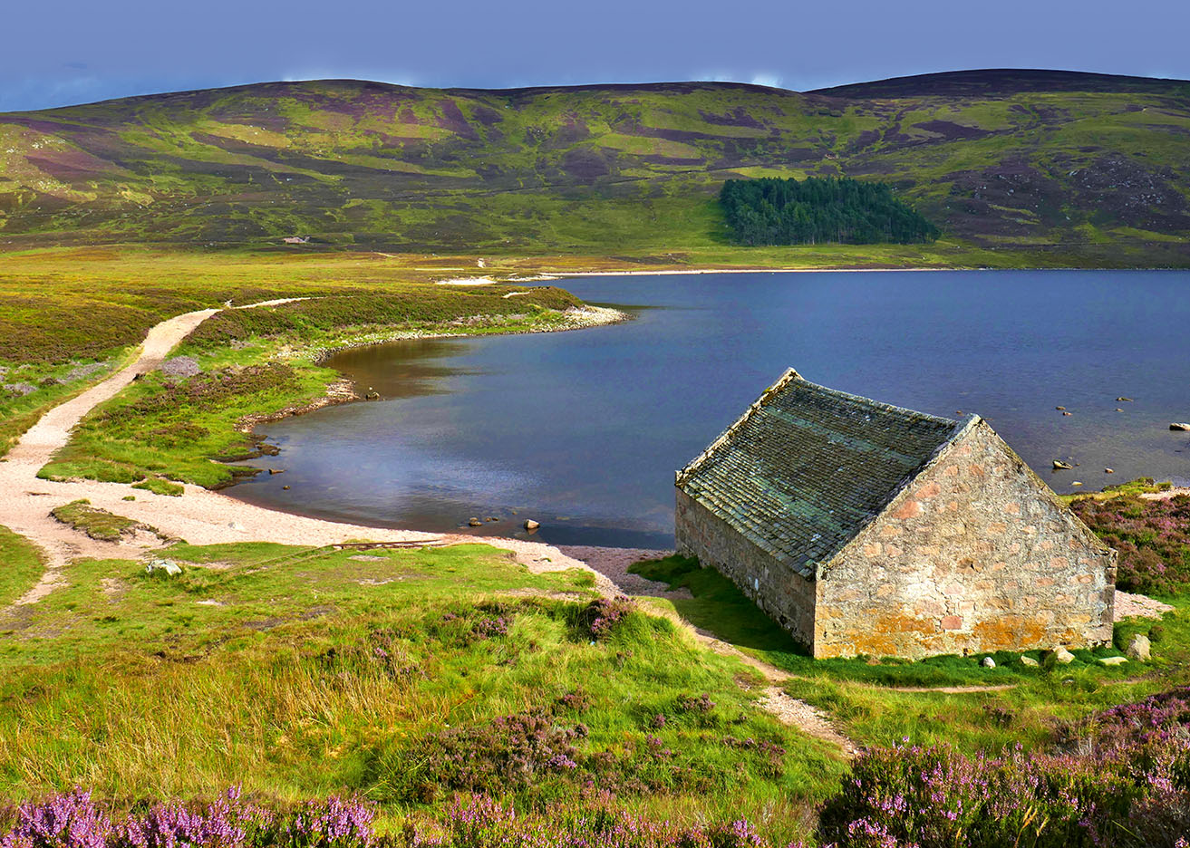
Loch Muick
You can walk along the track by the alluring and remote Loch Muick. With a boathouse on the loch, Scots pine and heather-clad hills, this is shortbread-tin Scotland.
We hiked up Lochnagar (3789ft), a popular (but tough!) climb that isn’t for the unprepared, even in glorious weather. We were lucky to spot a plump ptarmigan on the summit ridge and descended to the loch by the lively waterfalls of Glas Allt.
We continued south via Glenshee and then to the south edge of Loch Earn.
We sat on the shore as the sun dipped behind the hills opposite and reflected on the joys of this magnificent region, with so much to explore again and again.
Next Shows
The Big Land Rover Fest 11th - 12th July 2026
Experience The Big Land Rover Fest – a weekend of off-roading, live music, club displays and family fun at Newbury Showground, 11–12 Ju...
The Norfolk Motorhome & Campervan Show 17th - 19th July 2026
Join The Norfolk Motorhome & Campervan Show, 17-19 July 2026, for the Out & About Live Summer Party! Explore motorhomes, live demos, an...

Retro Festival 7th - 9th August 2026
Retro Festival celebrates timeless hits, vintage vehicles, fashion shows, and fairground fun.